I’ve been struggling to get to writing this post. Why should I struggle? I think it’s recalling the last stretch of our journey, and perhaps I’m not keen for it to end. Or, maybe I’ve just been lazy. Either way, this is the last post in this series, so let’s get to it.
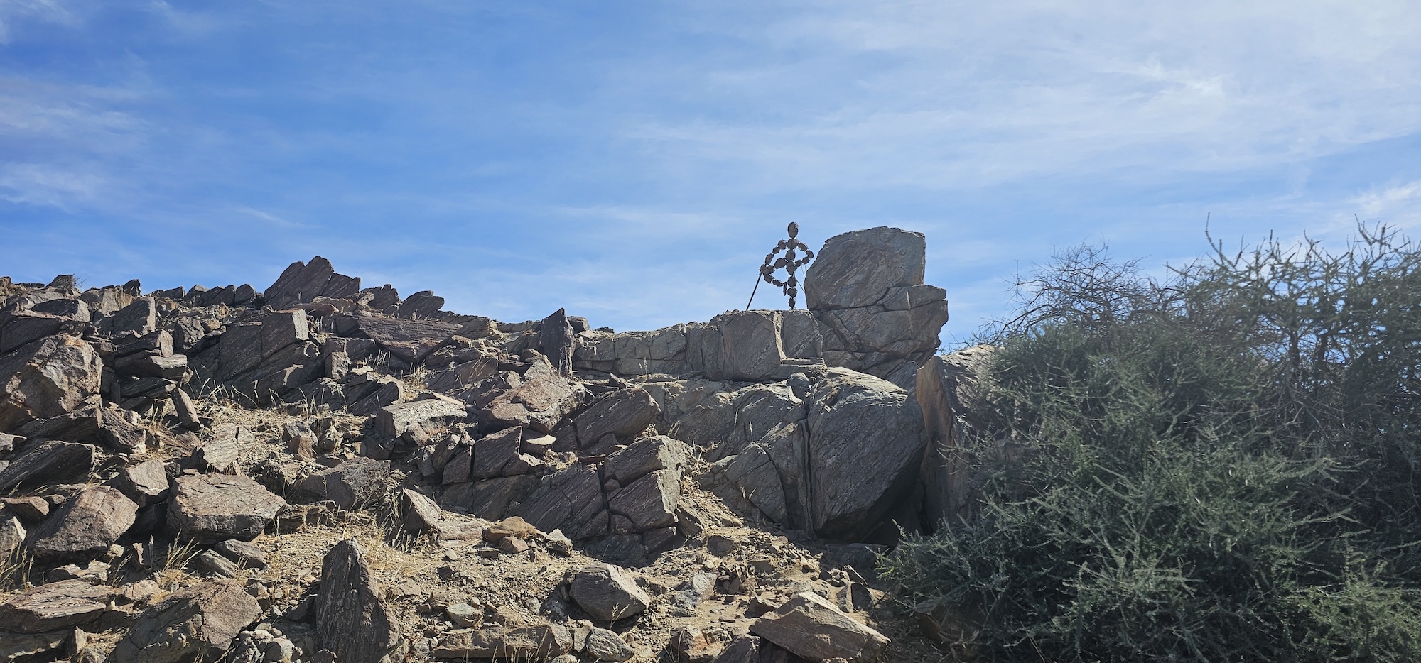
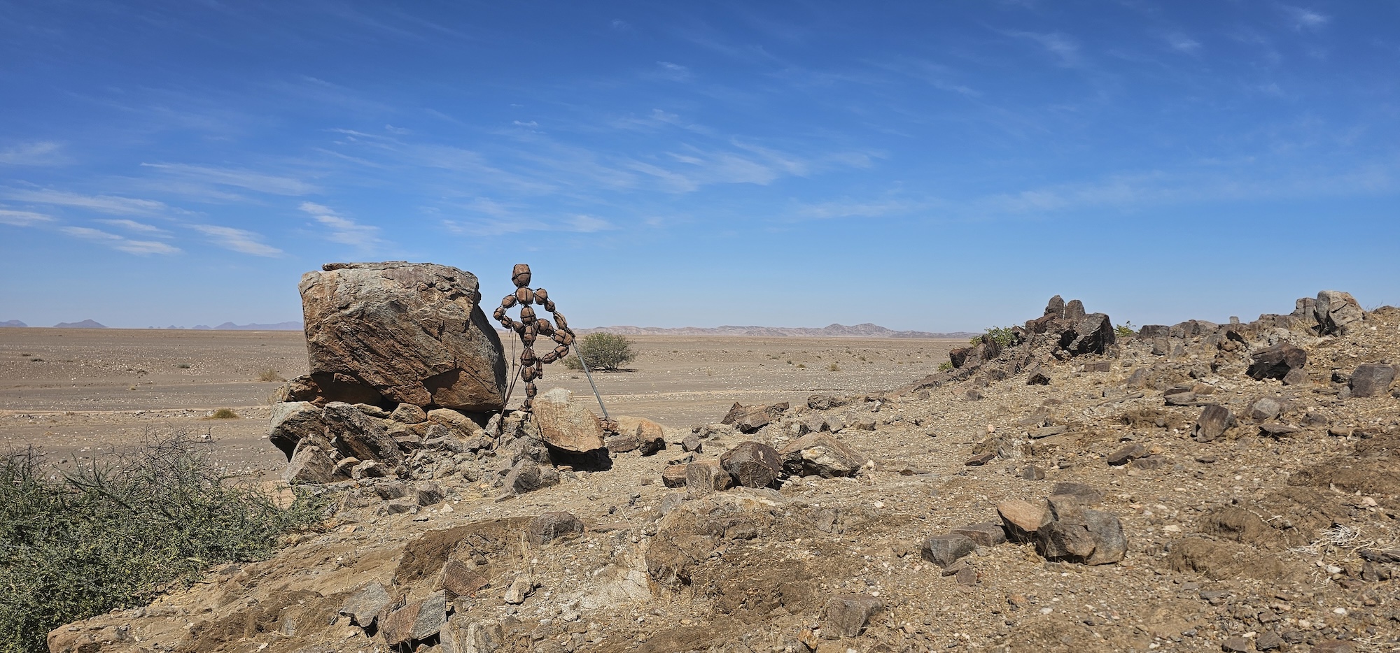
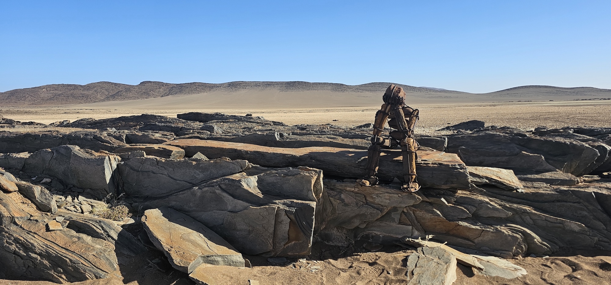
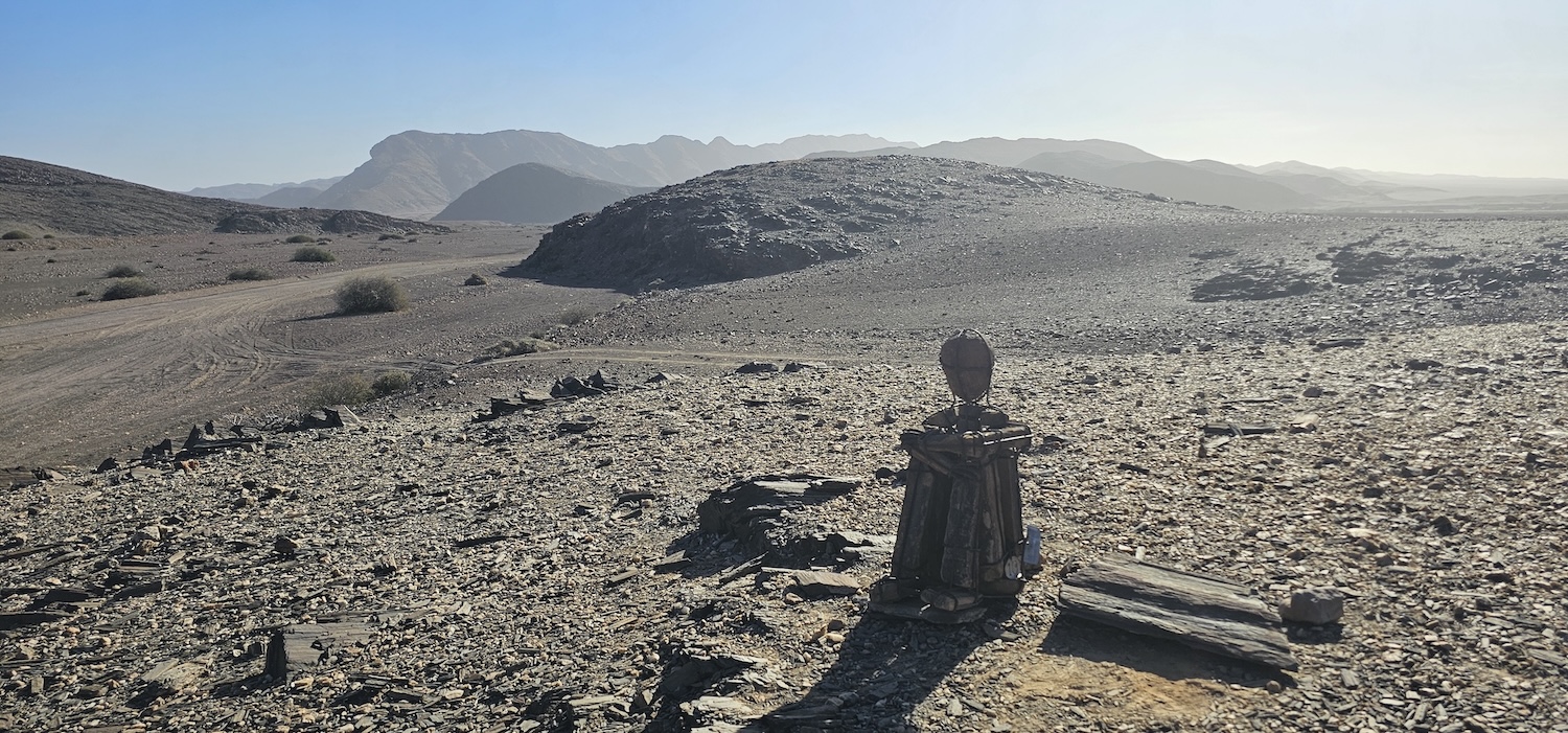
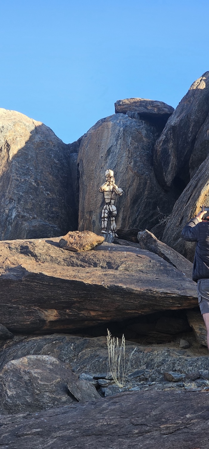
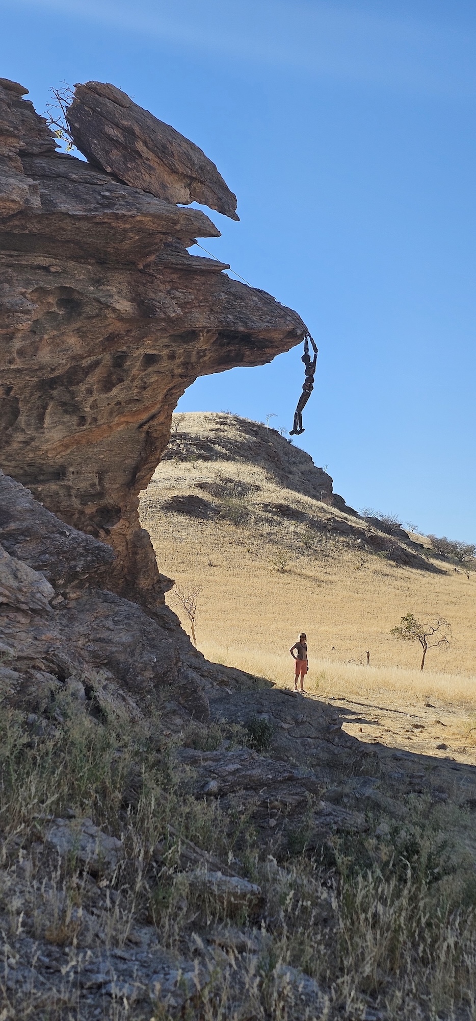
Today is all about the “Lone Men”. As we travel from Hartmannsvallei to the next campsite at Purros, there are quite a few of these weary travellers along the way.
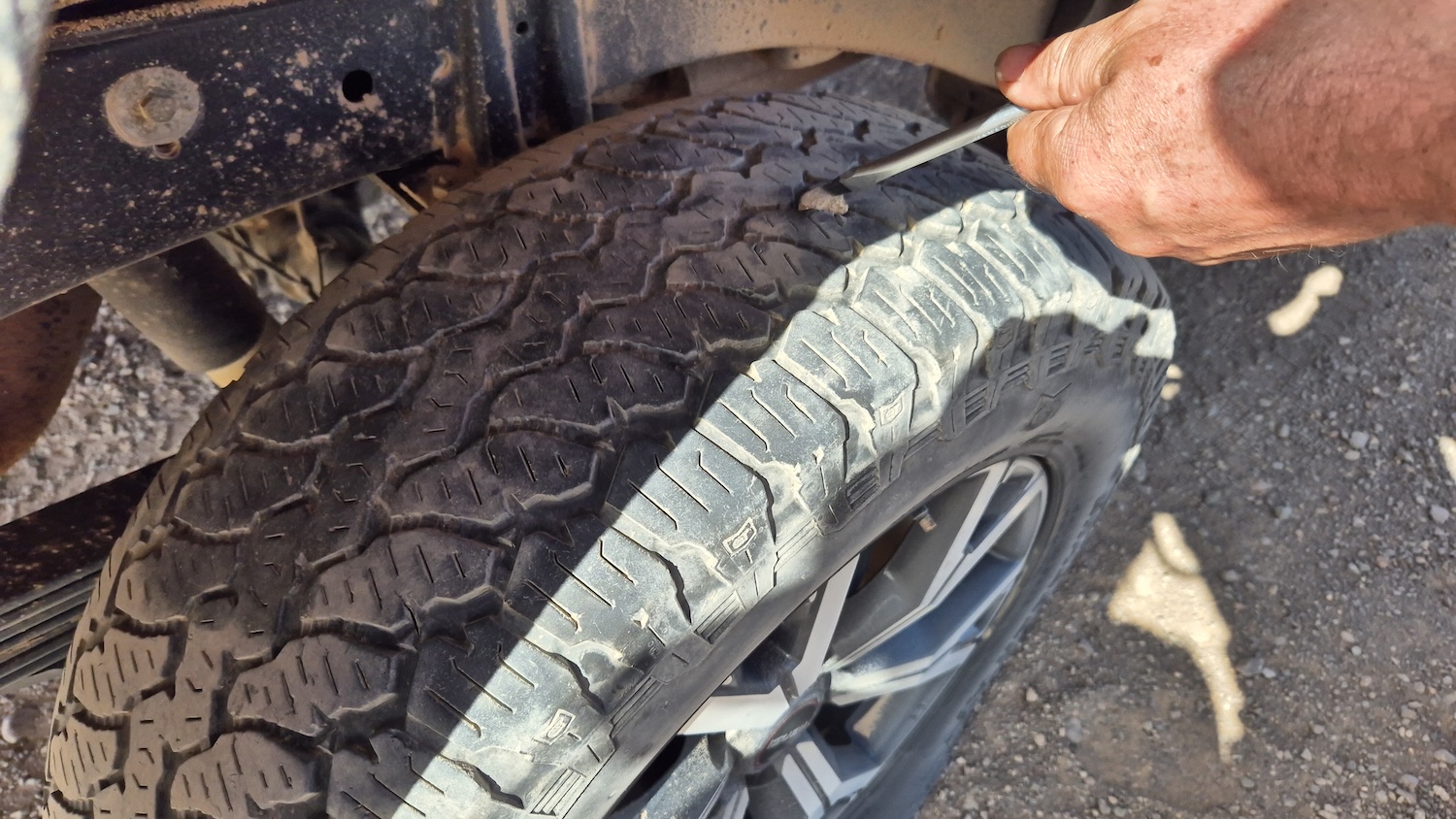
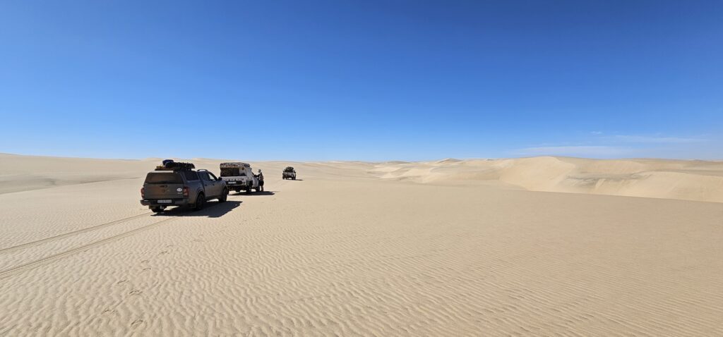
The stretch of road where we find ourselves is treacherous – the little sharp rocks sticking out from the road surface are more and they are sharper. Charl picked one up, puncturing on the tyre surface. We tried for a while to fix it, but simply could not remove the rock – it was in too deep. Eventually we changed the tyre. The ladies … ermm … they kept an eye on things.
Luciano lost two two tyres on his previous trip in the same way. You do your best to avoid the rocks, but this is not a matter of driver skill. Unless you drive forty km/h all the way, it is really difficult to see the rocks in time, and risky to try and avoid them.
Then we get to our first tourist attraction, and it is … somewhat unexpected.
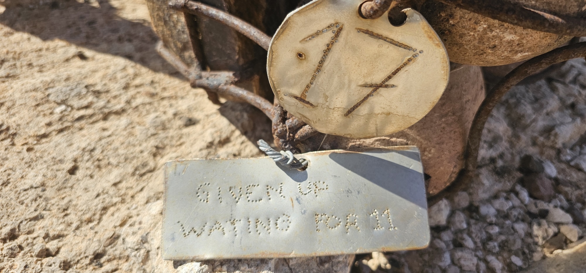
An orange drum!
Because the areas we travel through are vast, the roads are few and the landmarks are only distinctive to the trained eye, people have placed these drums along the way, as reference points.
There are other colours spread throughout the region, but this was the only one we passed.
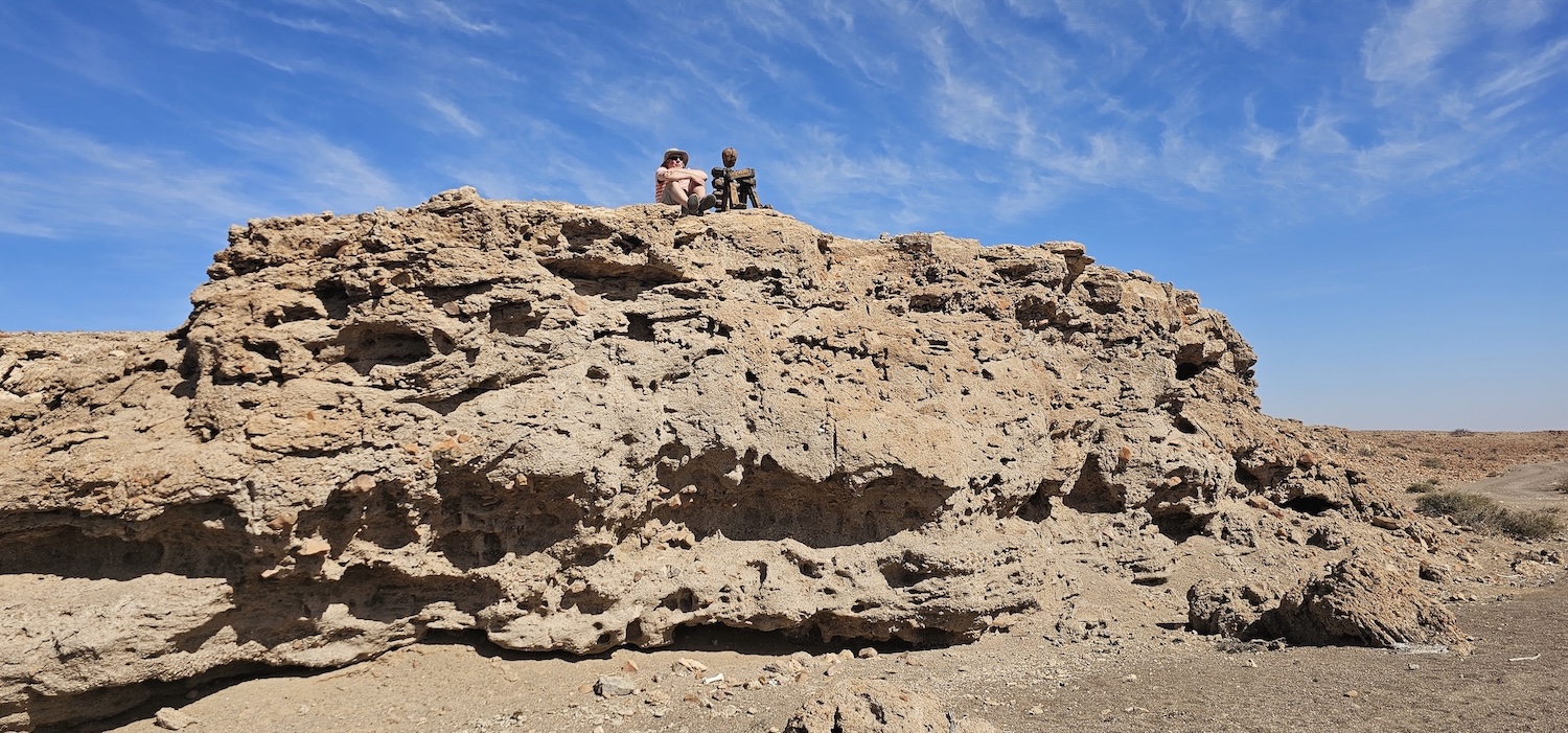
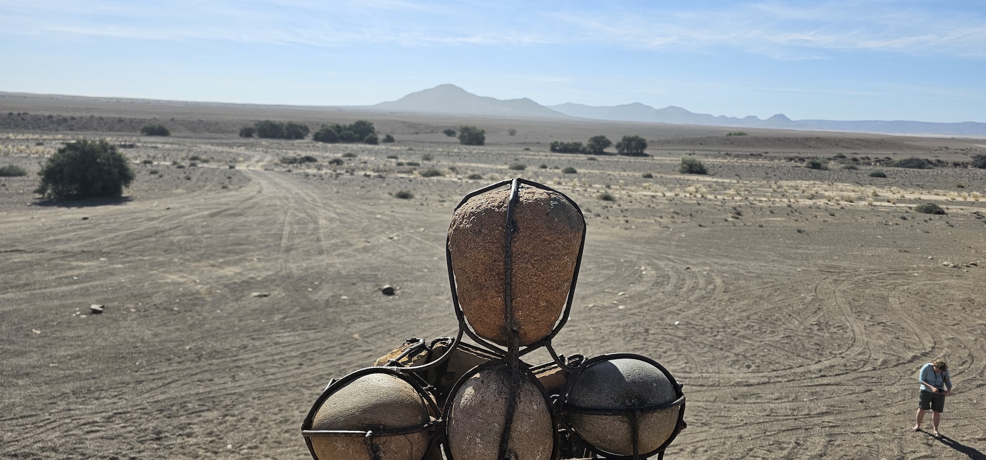
Soon after, the first of the lone men appear on a small outcrop. After him, another, and so on. Have a look at the gallery below, and, as always, there are more in the big gallery.
Lone manLone manLone manLone manLone manLone manLone manLone man
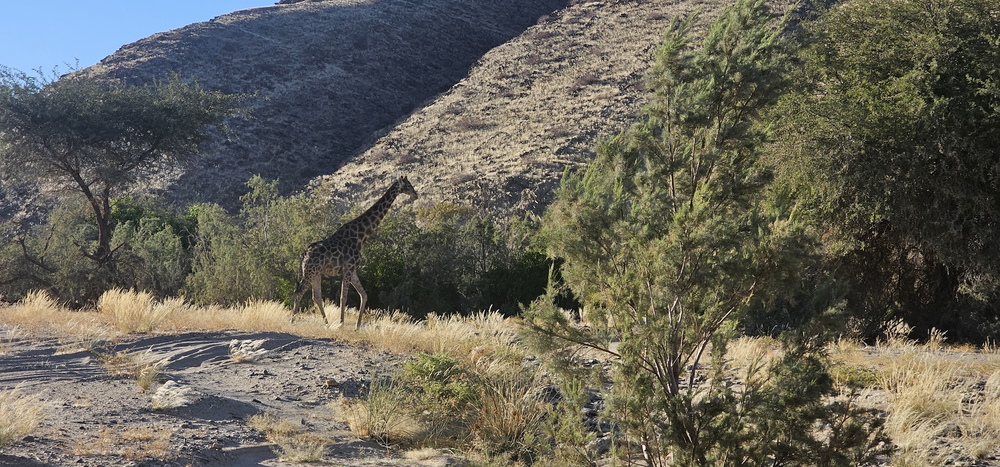
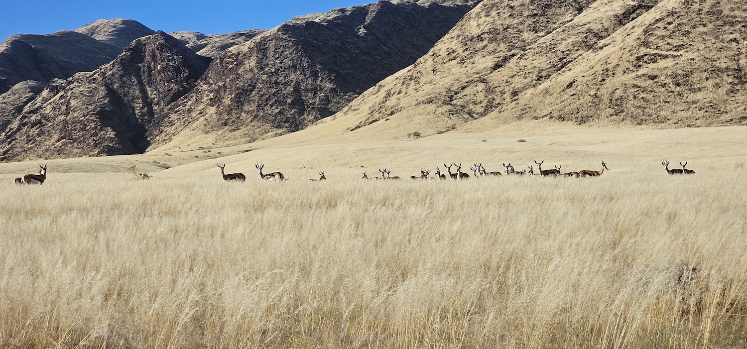
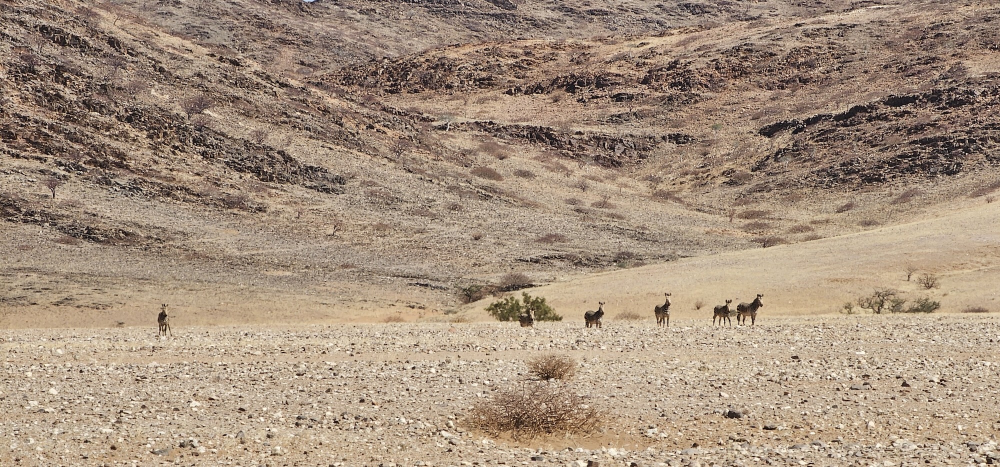
As we travel southward, the grass becomes denser and we are starting to see wildlife. In South Africa we are not used to this – there is a lot more game in South Africa, but most of it is fenced in. Here, you are travelling on public roads, and you can see Giraffe and antelope next to the road.
And let’s not forget that the desert lions roam these lands – we do not always know where they are, but they are there – so be sensible and take care.
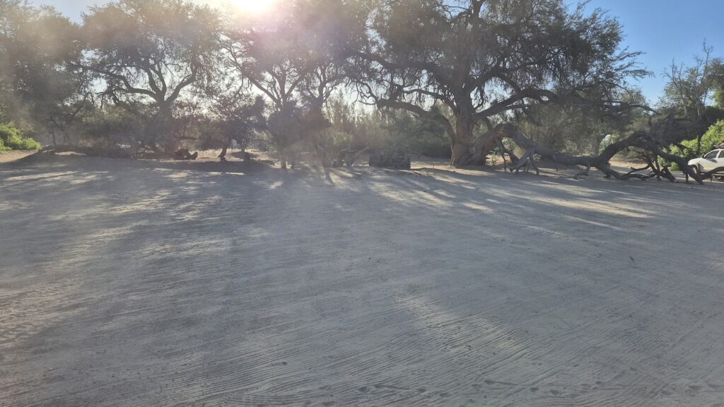
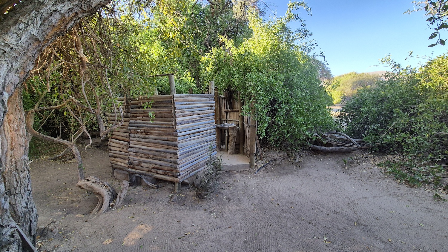
We finally arrived at the Purros campsite. Here the sand is as fine as baby powder.
The ablutions are luxurious (compared to previous couple of days) – in other words, there are flushable toilets and showers with hot water. What more could anyone ask for?
That evening, we had a special treat, with Luciano and Marius braaiing some of the best fillet I have ever tasted.
I realise now that I have not written that much about the food – but in truth, you could write an entire series of posts just on the dinners we had – the food was always good, and Marius is a braaier of note.
After dinner, we had a good couple of beers and reflected on our journey.
Then, we slept like the weary travellers that we were. Weary, but happy. The distances are far, setting up camp every day takes some time. Personally, I was quite a bit more active than my normal days of sitting behind a desk. So we were weary, but happy. Three months ons, and I would repeat the trip in a heartbeat.
In the morning, we drove to Sesfontein where everyone said their goodbyes. For us, it was off to a lodge and then on to Etosha – but that’s a story for another day.
Our itinerary included a day or two at Bosluisbaai, where fishing is supposed to be excellent. But, we had quite a bit of ground to cover before getting there.
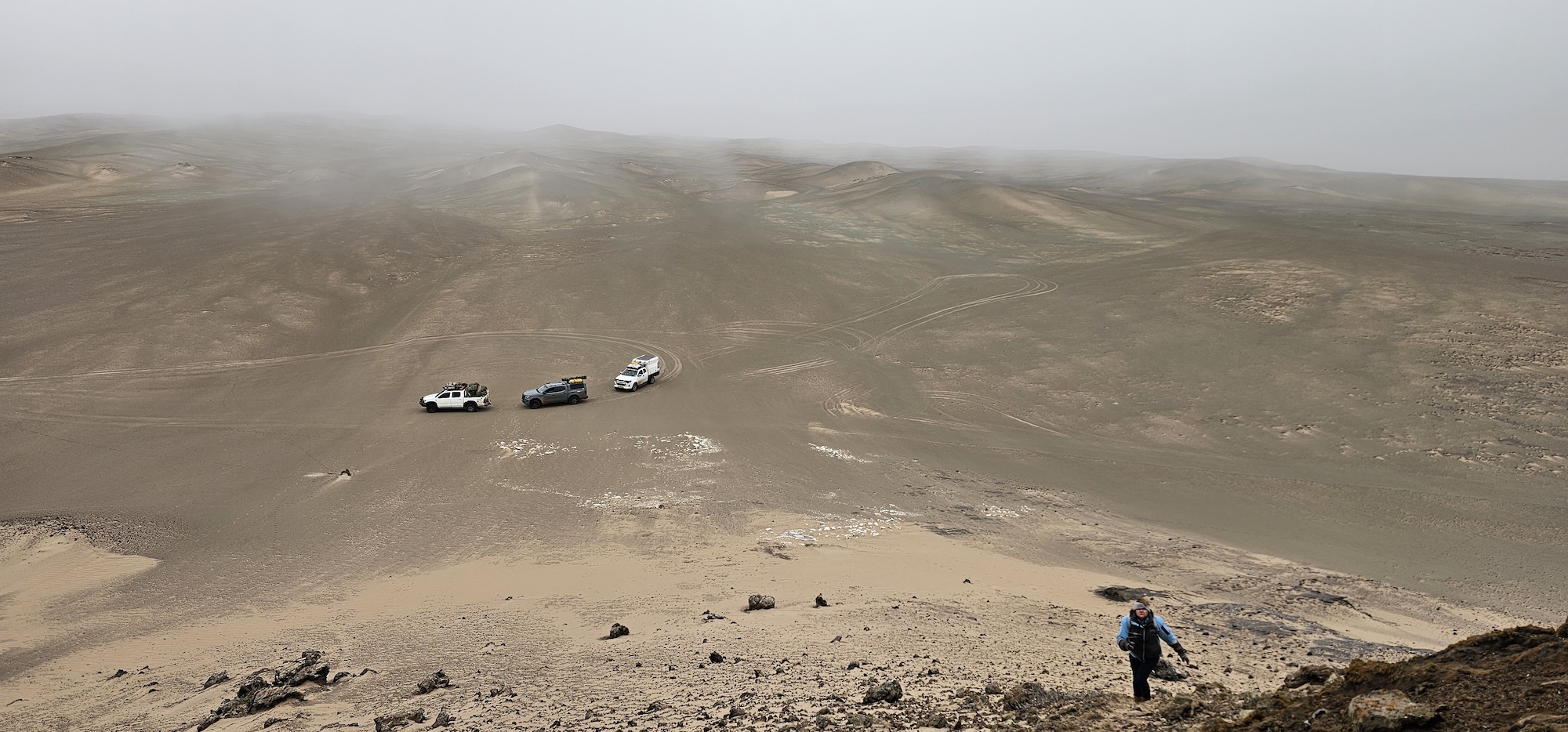
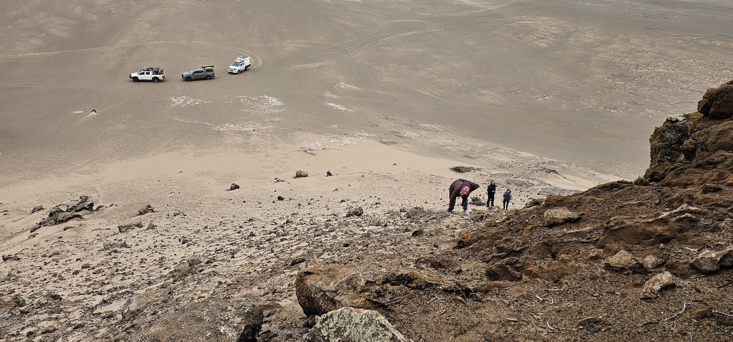
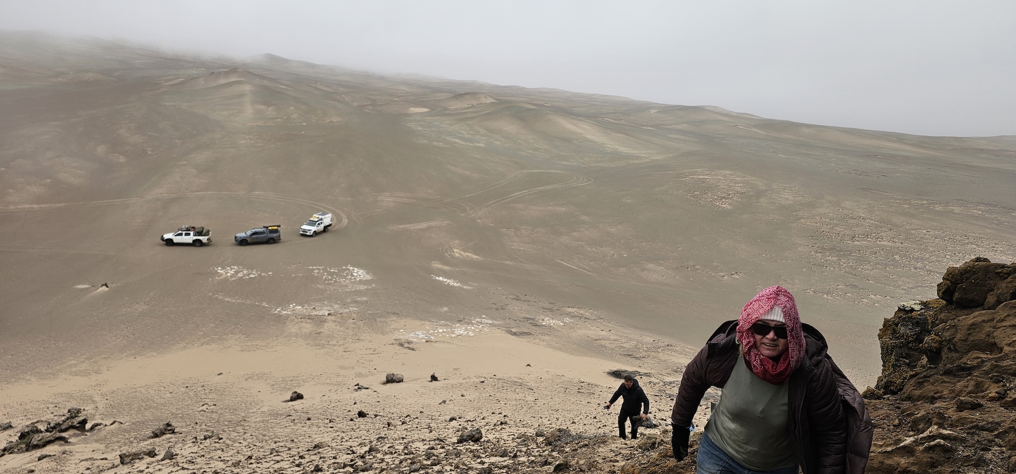
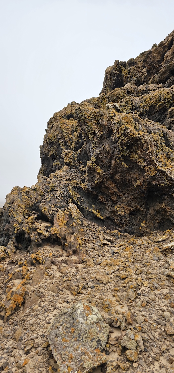
As we were already a little bit in-land, Luciano added to our list of sights by taking us to yet another destination that seemed to be through a gateway to a different planet. I cannot remember what the koppie that we ascended was called, but it was another great example of how drastic and quickly the landscape can change in this region.
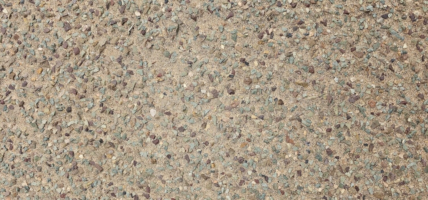
One minute we were still driving dunes, the next the ground became hard and had a distinct green tint. The colour comes from thousands of little green stones that covers the landscape.
The climb up the koppie was semi-tough, but worth it. The view from the top was spectacular, despite the misty conditions.
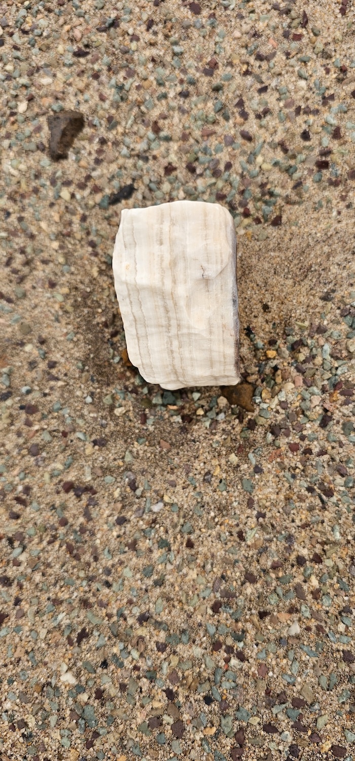
There were agate stones everywhere, with varying patterns and translucency. Agates are well-known for their beauty and are frequently used in jewellery. The many different examples kept us exploring for quite some time.
The rocks that make up the koppie are covered by lichens. This was not the only place we saw lichens, but was probably the example with most abundance.
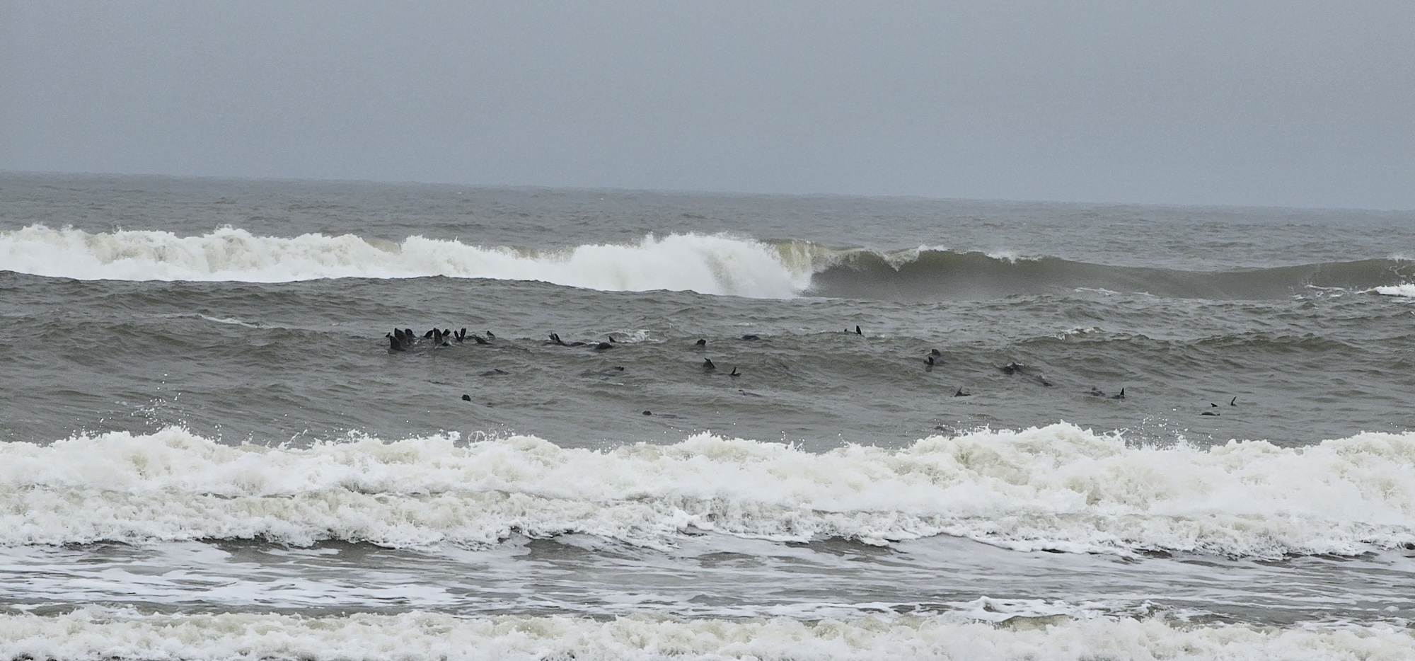
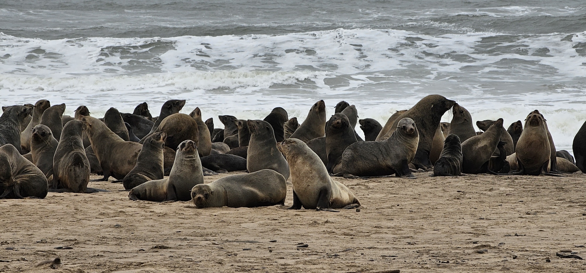
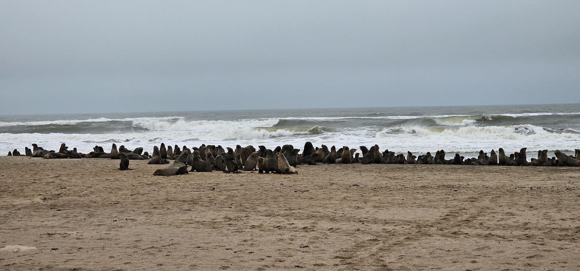
After that, we headed back to the coast and visited the well-known seal colony at Angra Fria. As others will tell you, if your windows are open you will smell the seals long before you see them!
I don’t know quite how many seals there are, but we saw three colonies with probably a good couple of hundred seals in each (how’s that for a precise answer)! Several seals were also in the water. Among the seals, jackals were scavenging and presumably looking for stray pups.
Apparently a seal eats approximately 4-6% of it’s own body weight in fish per day. Considering that a large cape fur male weighs in around 200-300kgs, there has to be a lot of fish in this ocean.
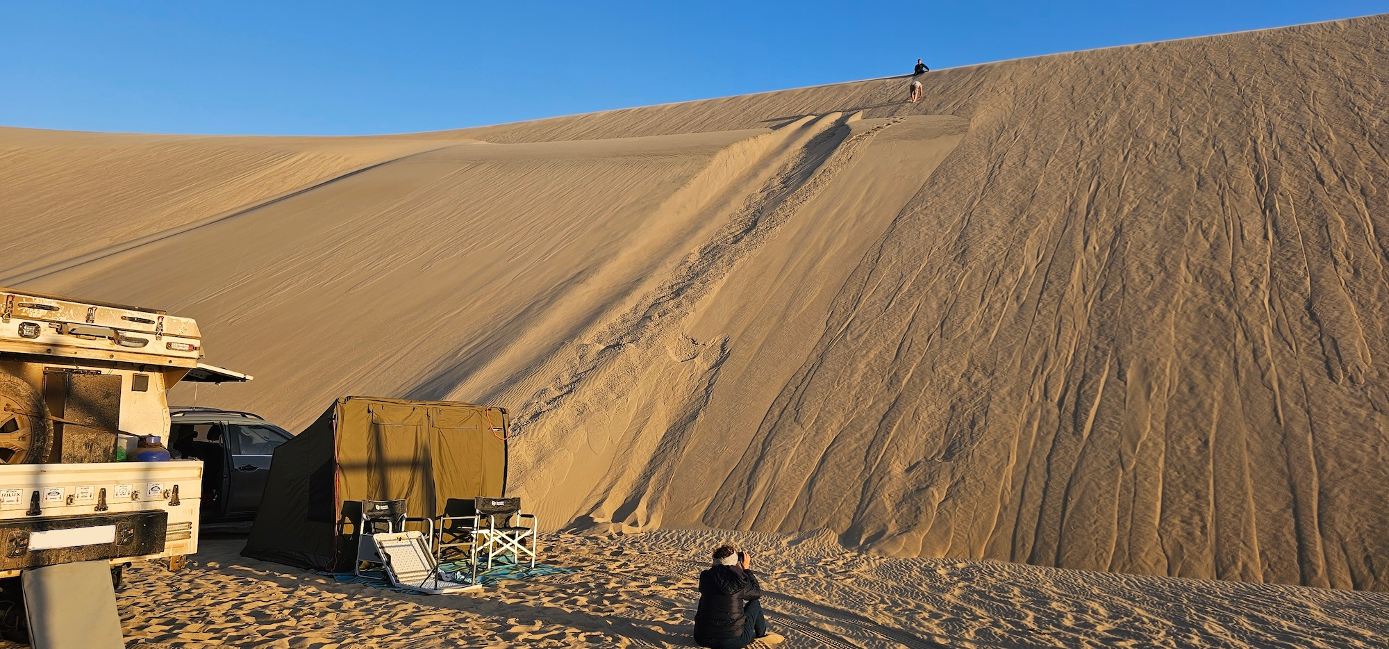
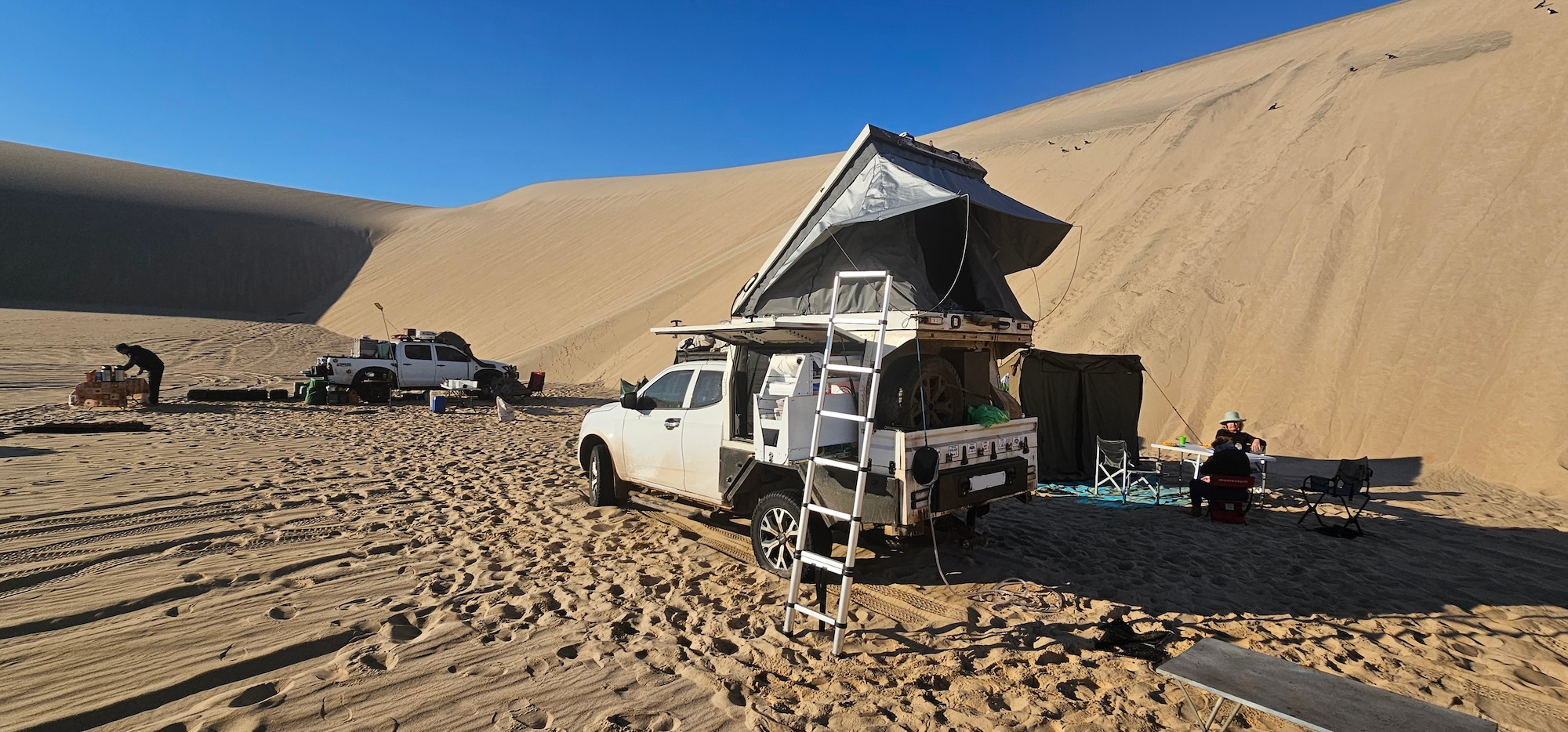
We were due to sleep in the wild tonight, but considering the strong wind, we opted to push through to Bosluisbaai. We could not use the camp, as a previous group was still there, but we were able to camp a bit in-land, sheltered by large dunes on two sides.
The following day, we were able to move to the camp where we had hot showers and a kitchen at our disposal for two days. We made full use of these luxuries. The bathrooms were excellent, and I made use of the shower following a mumbled comparison to the odour of a seal, coming from my wife.
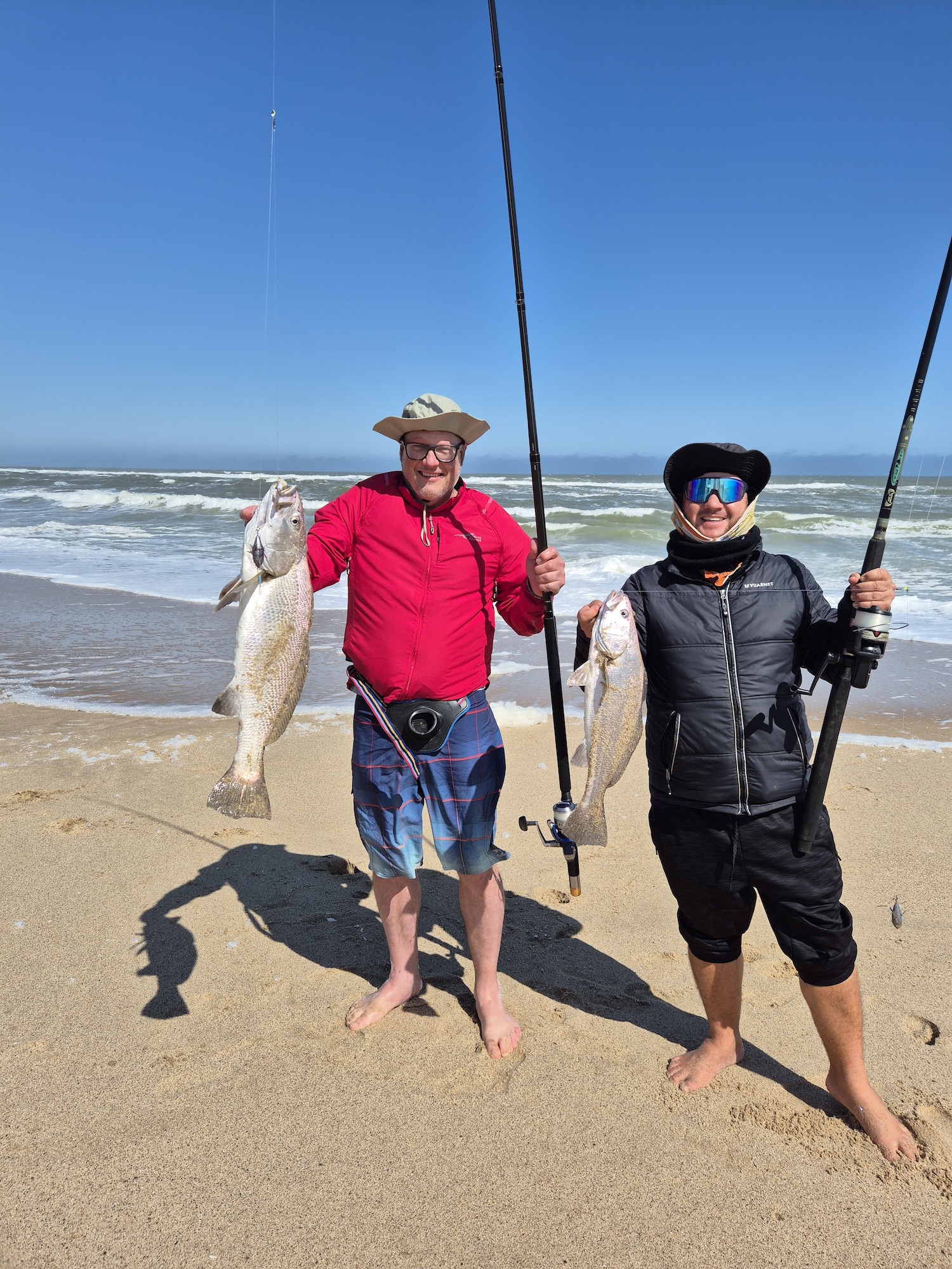
We took the opportunity to fish for the next two days. Whilst this is not a fishing trip, the days at Bosluisbaai are pretty yours to do what you want (dune driving, fishing, or just chilling with a book). Despite relatively short stints fishing, we caught quite a few nice sized Kabeljou.
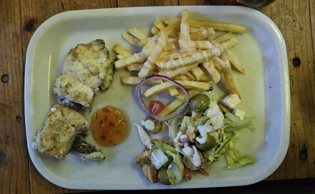
It is strictly catch and release – but rumour has it one made it into the pan.
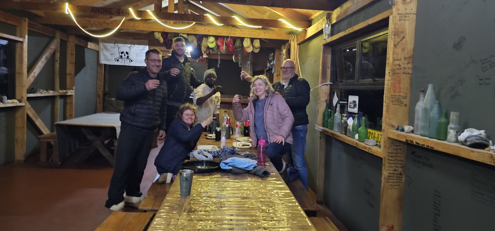
In addition to the kitchen, there is a big open area with a bar (unstocked) where we had dinner. These turned out to be quite festive. You will never have enough drinks or enough diesel on this trip – plan carefully.
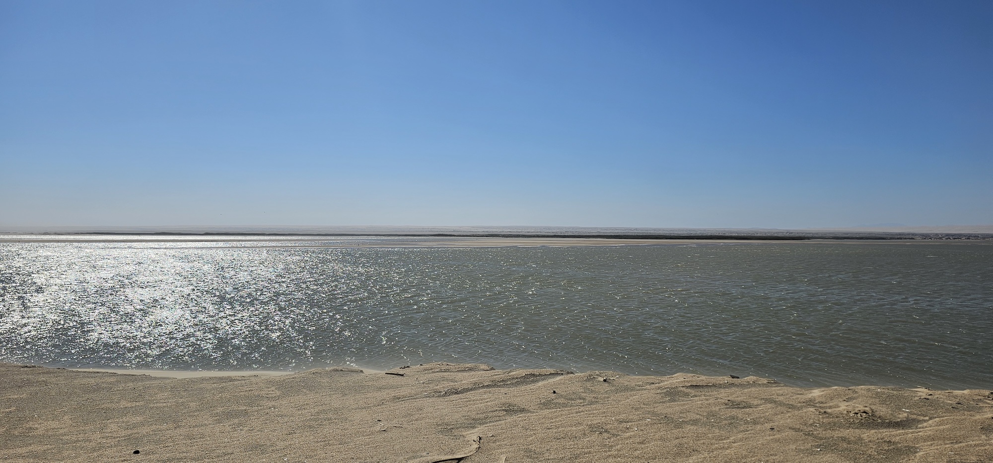
From Bosluisbaai it is a short drive to the Kunene river mouth. The road there goes past yet another abandoned mine (diamonds, this time). The river is not massive, but certainly bigger than anything else you’ll encounter on this trip. In the distance is Angola.
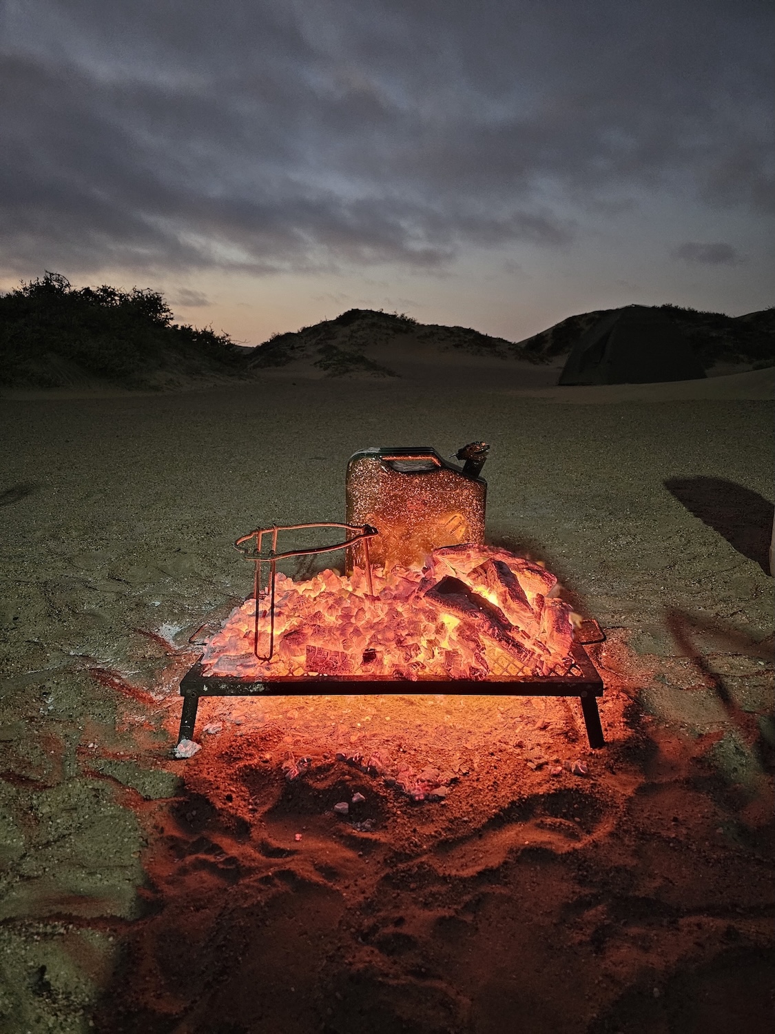
They have clean diesel at Bosluisbaai. The premium is probably around 50%, due to the difficulty of getting the diesel to the camp. If you are even remotely uncertain about your fuel, discuss it with the guide and rather fill an extra jerry-can. Once you leave Bosluisbaai, it is traversing dunes all the way into Kaokoland and your jaw will drop will as fast as the fuel-gauge.
But let’s keep the dune crossing for the next post!
Today we hit the road for most of the day. It starts at dawn and we meet the team at the Engen fuel station on the Henties Bay road. Clearly this is a popular stop for all traffic going north. Besides having really helpful staff, they are well-versed at filling jerry cans, they sell big bags of wood that is perfect for the trip and the shop is well-stocked with items. They don’t only sell the usual cold drinks, sweets and chips, but also sandwiches, salads, cold meats, wraps and other items that are perfect for lunches.
Here we met the guides for the first time – Luciano and Marius (his Ovambo name is Daleni – he is fine with either). They fitted the two-way radios, explained how we will travel and answered our general questions. In bigger expeditions, there will be two guide cars, one bringing up the front and one the rear, but in our case we were only two cars (three with the guides) and so we followed the guide car.
The morning was extremely misty – we could hardly see the car in front of us but this is where the radios come in handy. Here and there the mist lifted, but just as soon it would envelop everything again. Our first stop was the town of Hentiesbay, which is well known amongst South African shore anglers for fishing. We had a quick stop at the Henties filling station and I filled up again despite the short distance travelled (around 70kms). When in doubt, fill up!
Leaving Henties there are several fishing spots along the way, and they have colourful names such as “Horing Bay, Rondeklip, Buurman se Gat, Popeye” and so on.
More information on Henties fishing is available on this document.
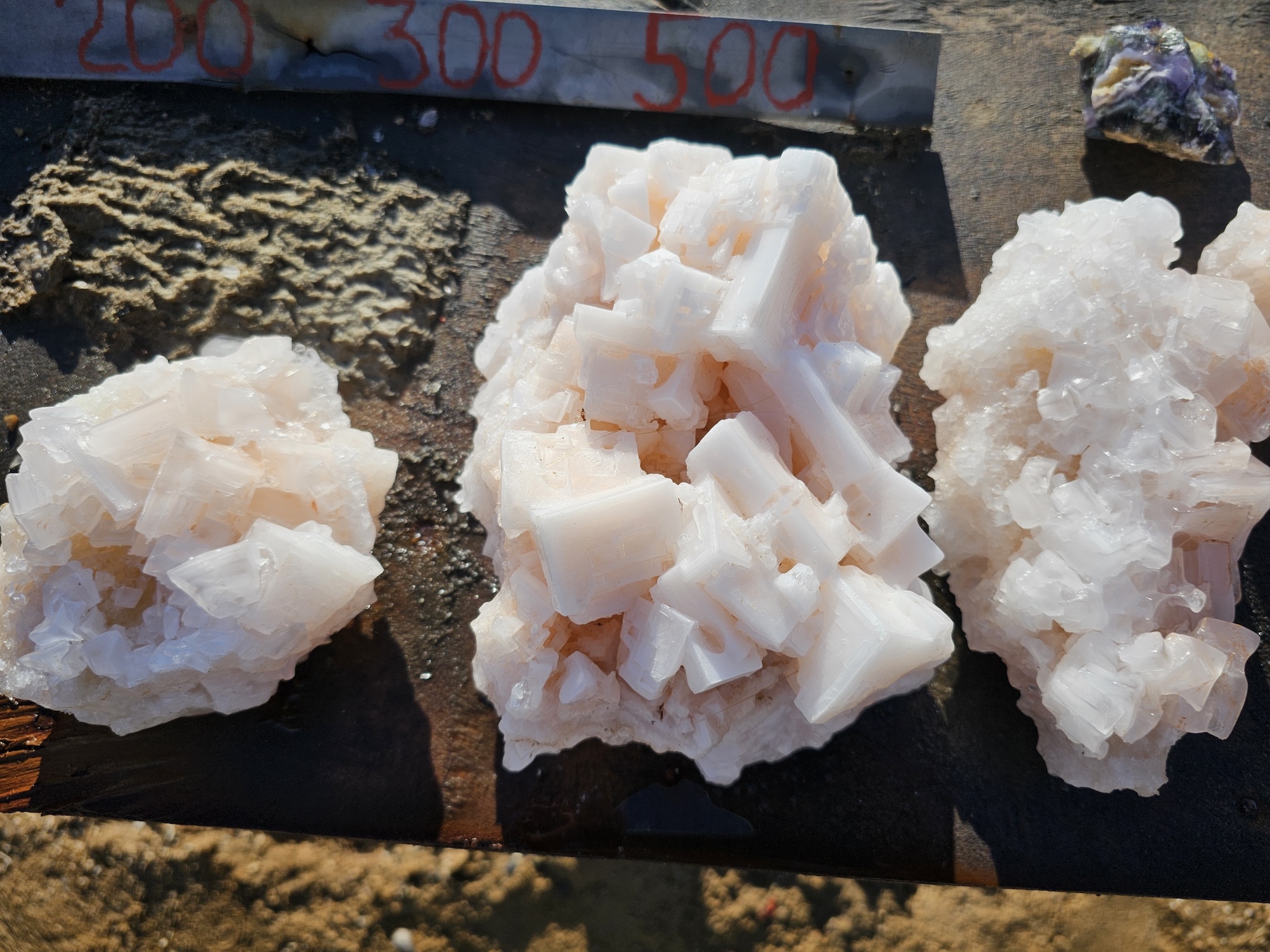
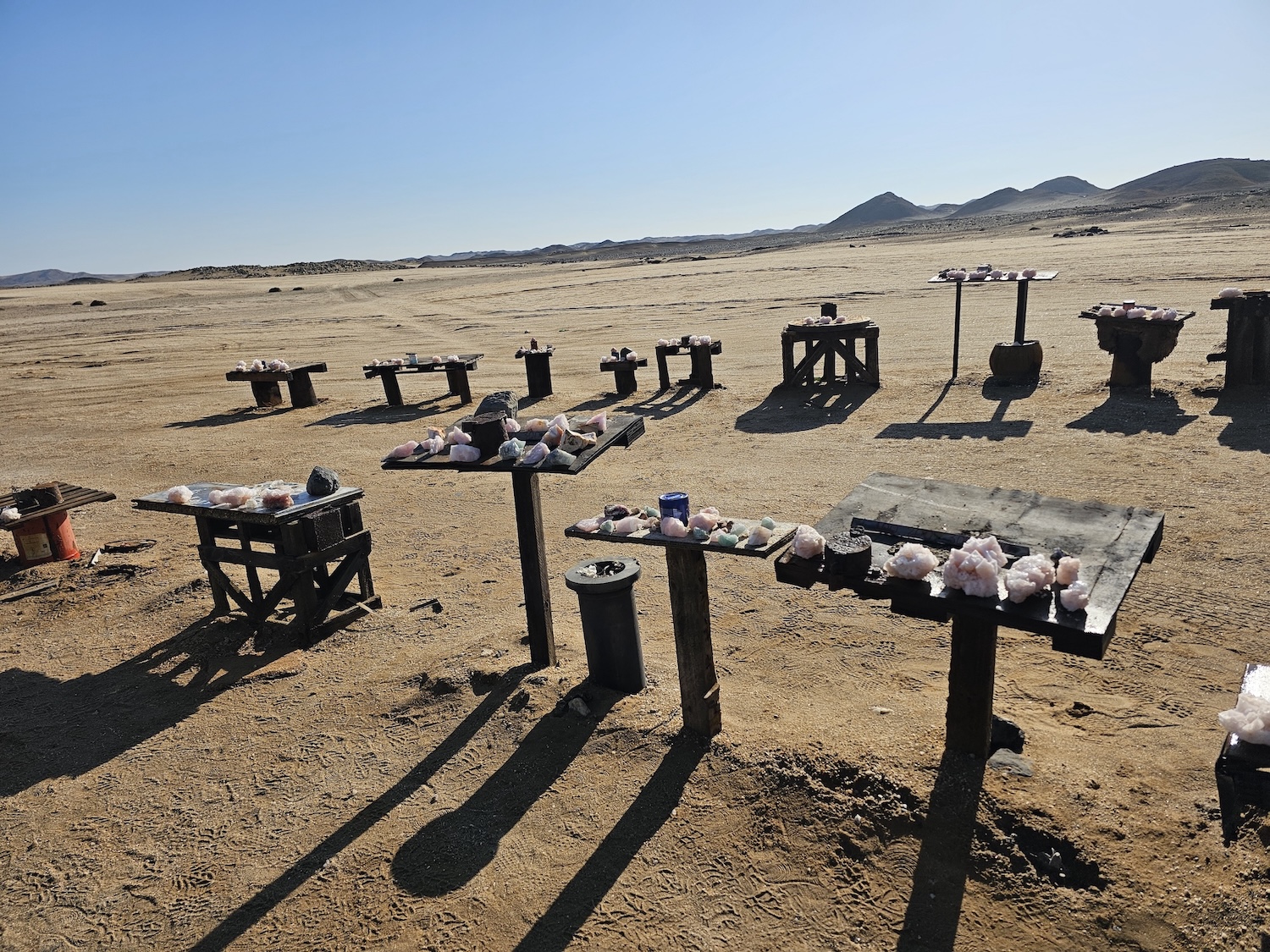
Exactly one marathon out of Henties Bay (42,2km), just past some salt works, there is a place next to the road where locals put some beautiful salt crystals on display. You are welcome to take some, and leave a tip in the honesty box.
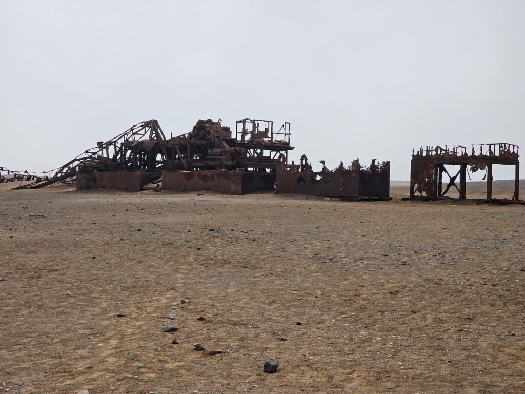
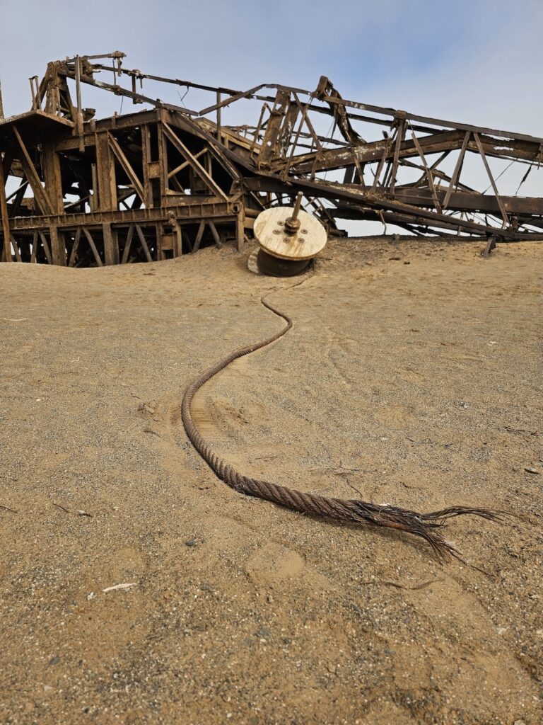
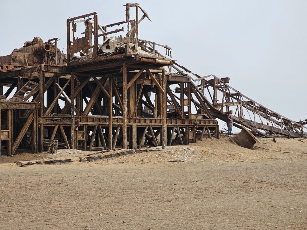
A little further, we get to the skeleton of an old oil rig. It is a beautiful setting for photography. Large, rusted metal structures seem to be buried slowly under sand. The competition to the slow burial is rust, wind and erosion.
Only time will tell who wins the race. But for now, the rig is not ready to give up – it has been there since the late sixties, and still endures. Apparently the bank recalled their loan in 1972, and the rig was left abandoned. The pics below are clickable, and please have a look in the gallery for more.
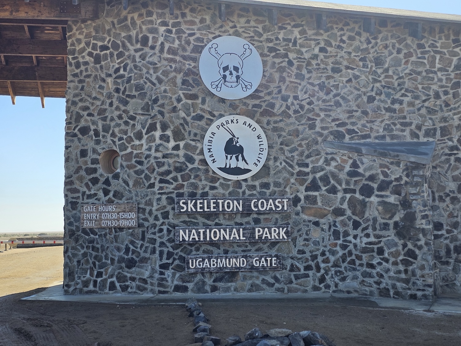
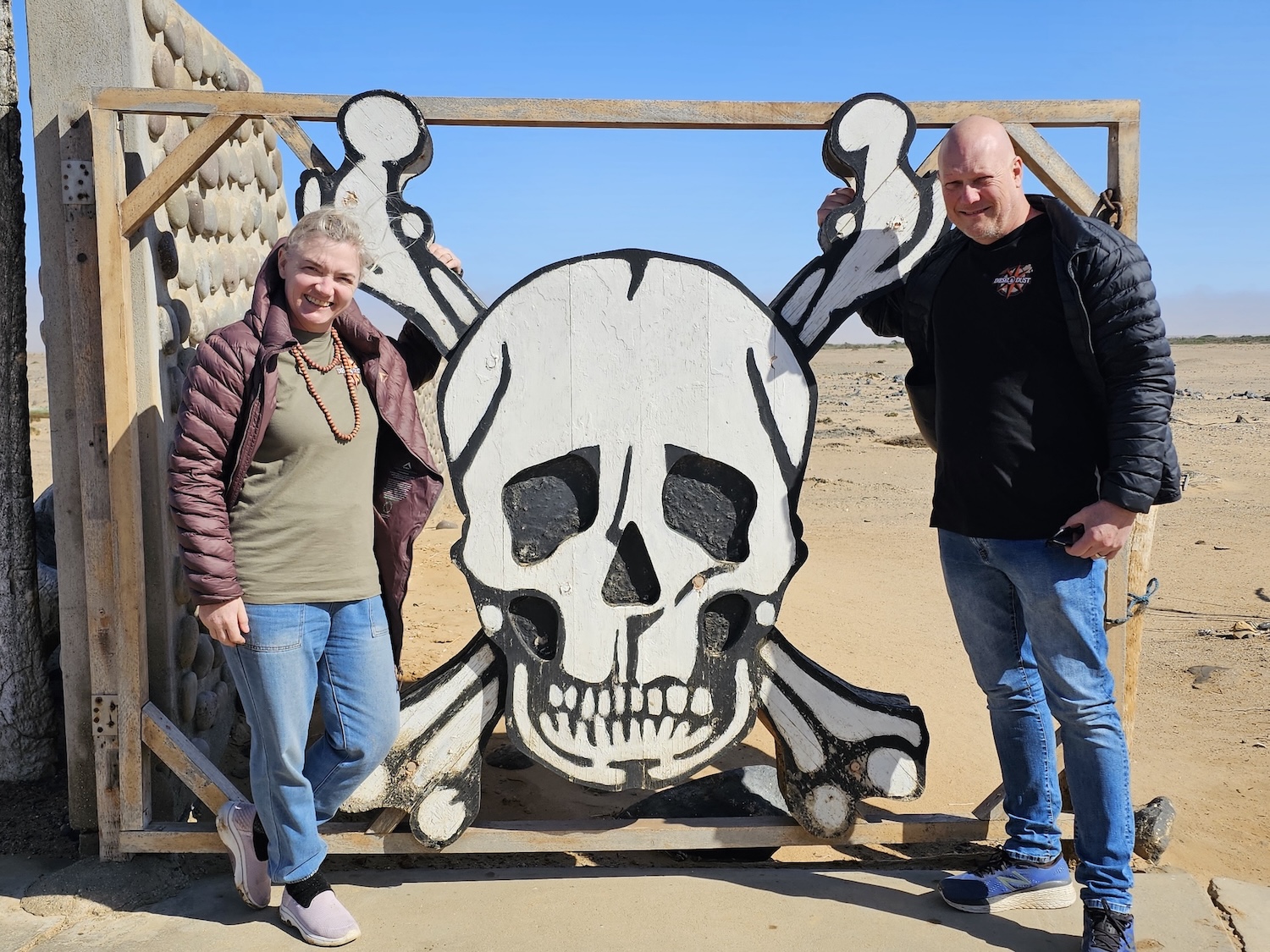
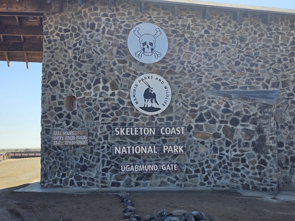
Leaving the rig, we kept travelling north to the main entrance of the Skeleton Coast National Park. Here the guide will pay the fees applicable to your trip, but the driver of each vehicle is also required to complete a register.
They had some T-shirts for sale as well as stickers. The prices were reasonable considering the location. There is a small display area with samples of minerals, stones, photos of wildlife and so on.
Before proceeding, be sure to take a photo at the iconic gate!
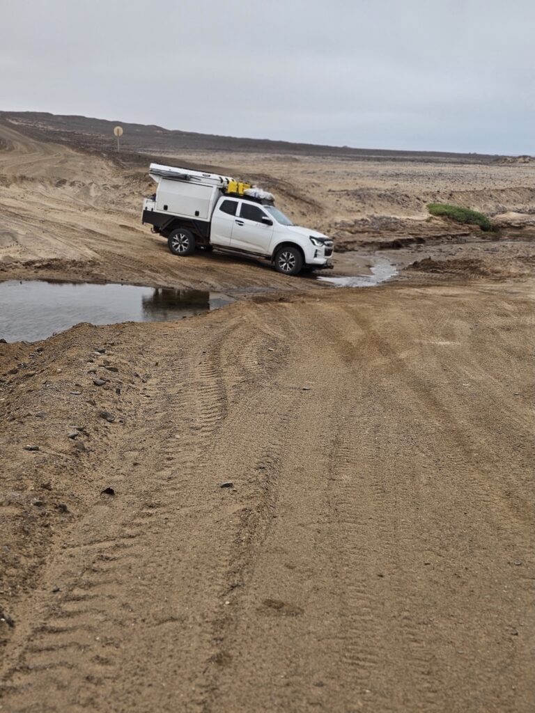
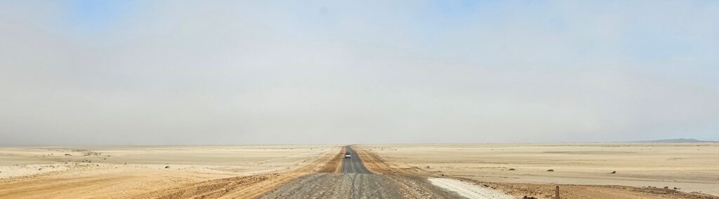
From this point we proceeded to Terrace Bay. The road to get there is fine, with a few moderately difficult sections, and a very small river crossing (I guess it could get fuller during the rainy seasons, but it was negligible in our case).
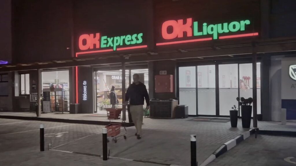
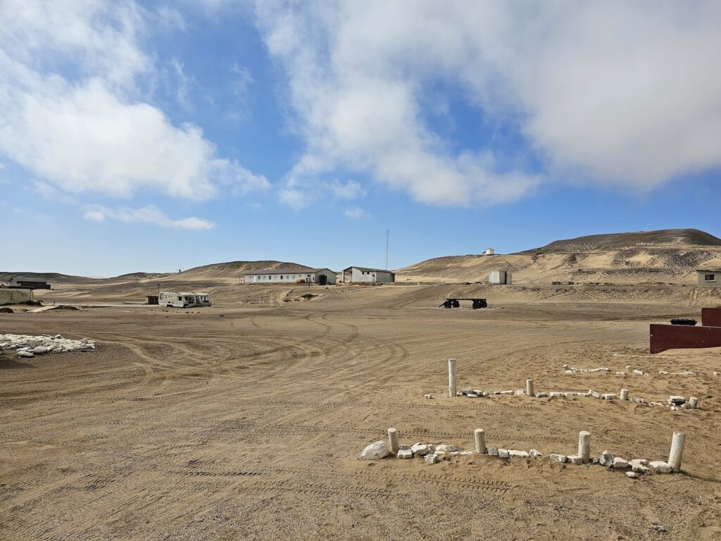
We were told that we could potentially fill up with fuel at Terrace Bay (the briefing document describes it as the last fuel stop) – but there was no fuel to be seen. There is a small shop and a small liquor shop.
Apparently Terrace Bay was a favourite fishing spot of Sam Nujoma, Namibia’s first president. He had a very strong connection to the place and loved spending time there.
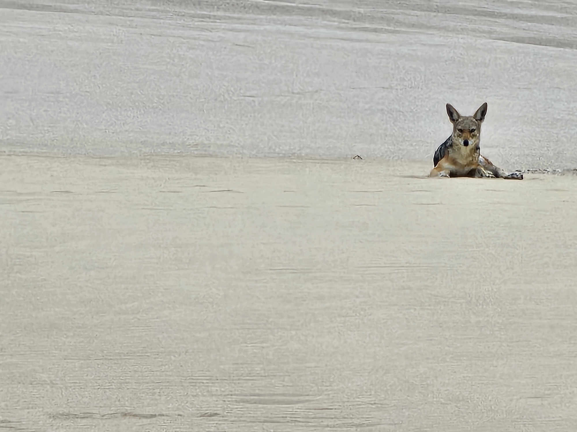
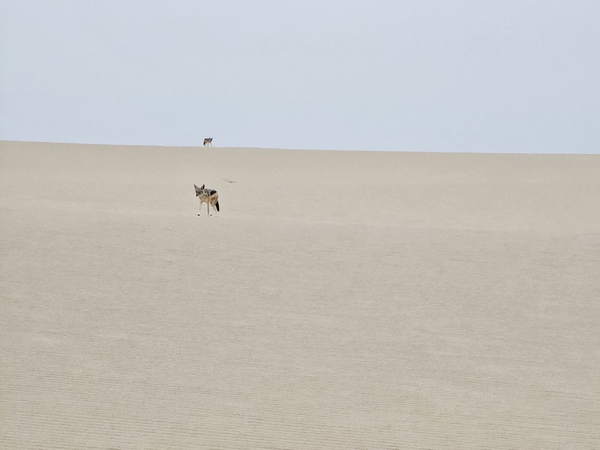
The end of day was drawing near, and we had to start finding a spot to camp for the evening. This was just a little further north, and perhaps 400m inland from the ocean. Here was a chance to relax, take in the beauty of our surroundings and to realise that this is something special: there are no people, no lights, nothing around but ourselves, the sand and a few nosy jackals.
Luciano and Marius were quick to inspect the jackals from a distance – it is not impossible for them to be rabid, but apparently their behaviour would be so erratic that it is easy to spot. I could photograph the jackals for hours on end, more photos in the gallery.
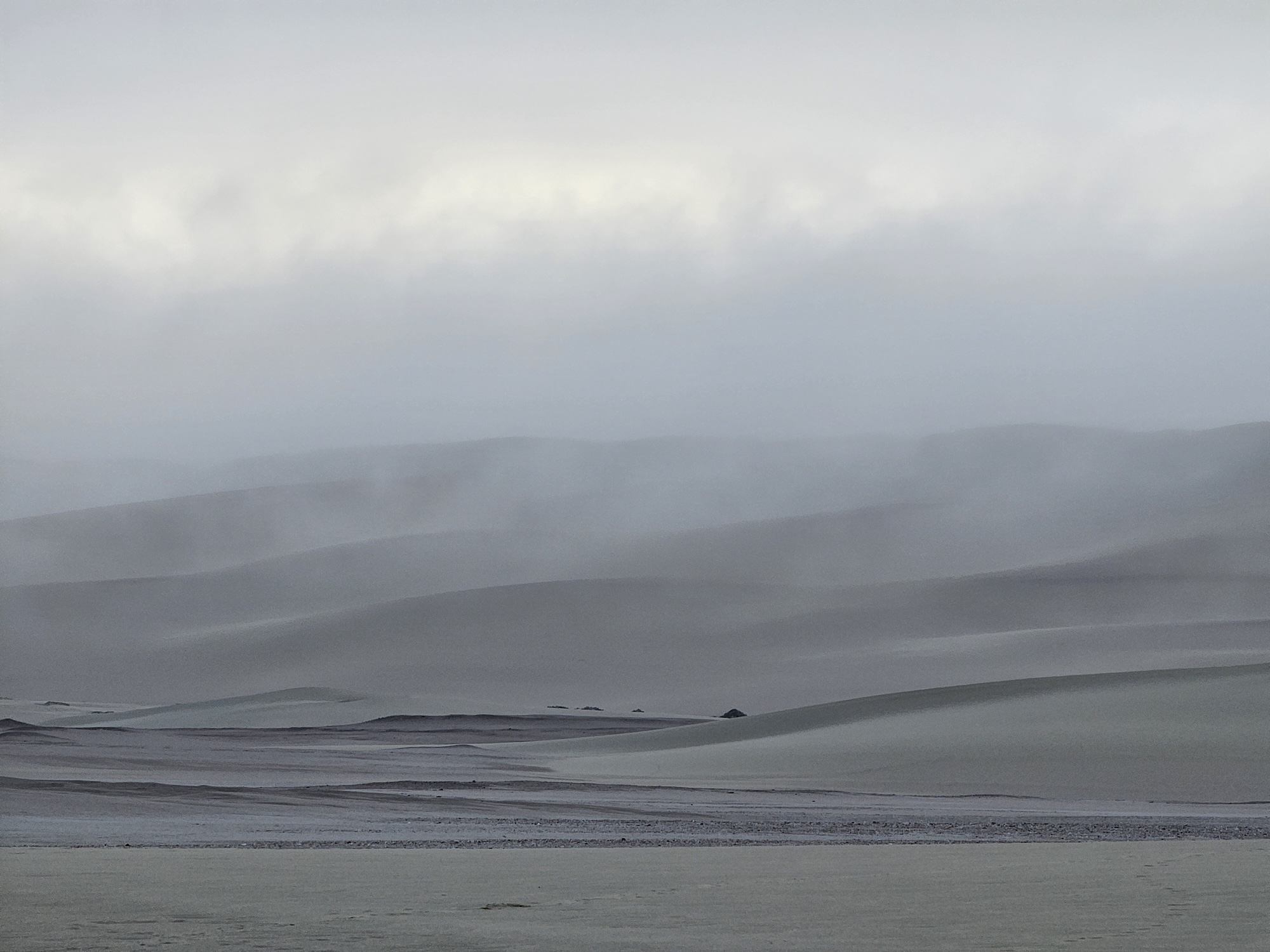
Whilst dinner was being prepared, we set up the tents and walked up the dune behind our camp to a spectacular view. During the night there was a tiny bit of rain, and the picture below was taken at sunrise the next morning.
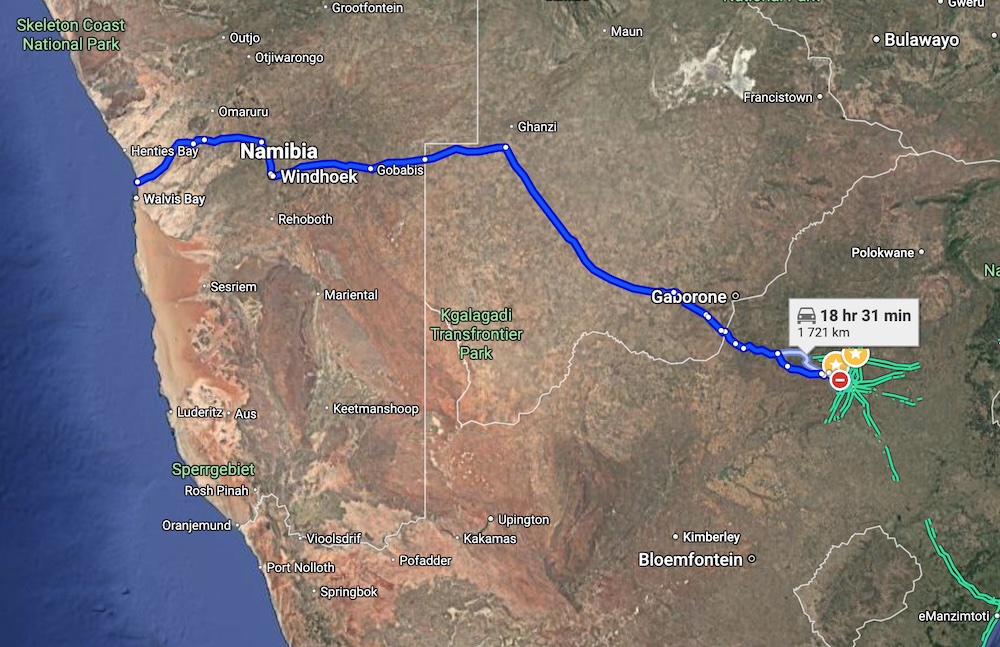
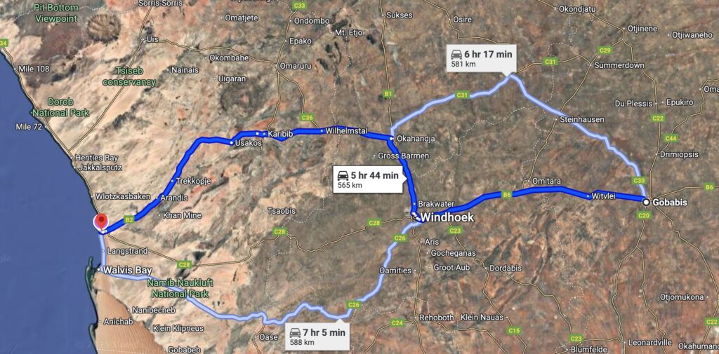
Swakopmund is on the West Coast of Namibia. At the time of writing (which is a Saturday morning, with close to zero traffic) it will take 18 hours and 31 minutes to get there.
If you want to get there, the most important thing is to remember your passport!
In my youth, that may have been palatable, but these days I prefer to enjoy the journey as much as the destination. If you just want to get there, bear in mind that the road through Botswana implies two border crossings (RSA-Botswana and Botswana-Namibia). The borders only open at 6am, and they close around twelve hours later – but please confirm these times before you start.
Alternative routes to the one depicted above (from Gauteng) are through the Kgalagadi transfrontier park (another great destination, hope to have a post soon!) or via the Northern Cape (I know there is an entry point at Vioolsdrif, not sure where else).
The Northern Cape option is probably the better one for Capetonians – if you are from elsewhere in the country do a bit of research. The 4×4 community forum is a fantastic source of information (https://www.4x4community.co.za/).
A very popular option is to fly to Windhoek, and then proceed in a 4×4 rental. I was surprised at the amount of people I saw going around in rented 4×4’s in Namibia – many of them from RSA. I was also surprised at the affordability (starting at R2 500 per day). This may seem expensive, but compared to owning a 4×4 and getting it kitted out it is actually very, very cheap – most options include a rooftop tent, fridge, etc.
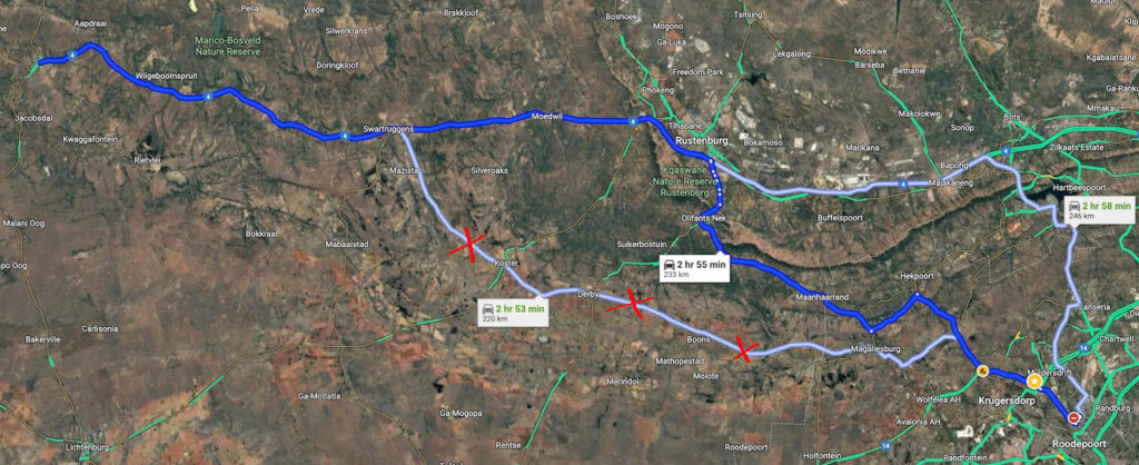
We opted to start our travel on a Wednesday afternoon and to sleep over near the Botswana border at Zeerust. To get to Zeerust from Johannesburg, make sure you take the Rustenburg road as indicated in the map below and avoid the Koster option if at all possible. I have marked it with red crosses and it is what we call in Afrikaans a “kak pad” – which means very bad road. Again, that is at time of writing, but I don’t think anything can save that road except a very long term effort, which is unfortunately not likely to happen.
Avoid road with red crosses
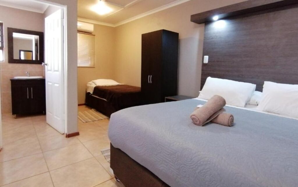
In Zeerust we stayed at a guesthouse called “Goedehoop”. There is no website but booking options are available both on booking.com or lekkeslaap.co.za, with lots of pictures. For us it was just an overnight stop, but it is really good accommodation and central in Zeerust, so you can get to the border early the next morning.
If you want to explore a bit around Zeerust for a day or two, there are game farms a couple of kms outside of town, but we didn’t stay there. Below is a picture of a typical Goedehoop room.
A typical room at Goedehoop guest house
We got up very early the next day and were at the border gate around quarter to six. There was a long line of trucks, you may pass these, there is a different entry gate for them.
I may write a future post just on crossing the border, but for now just ask everywhere you go, where to next. The information on where to go and what to do is non-existent; furthermore, it is far from logical. Every border post requires you to exit the country you are leaving, after that you drive to the country you are entering and go through a similar process there.
This is the process – don’t get upset or raise your blood pressure – it impacts only yourself and makes things even slower.
One important point (that a friendly couple told us – no official is going to share this with you) – if you are coming back through Botswana again, you can buy a re-entry visa/permit – it saves quite a bit of money.
You will probably be tempted to change a bit of money to Pula at this point (so was I) – but know that it is expensive to do so. Every place that we stopped at in Botswana, accepted cards and the card machines worked – but I would take some Pula anyway, just in case. If you don’t happen to use it, put in fuel with it on the way back.
The road through Botswana is called the Trans-Kalahari highway. The first 15km after entry into Botswana has quite a few potholes, but from there onwards the road is in really good condition.
The Trans-Kalahari Highway
It was a good thing that we had some Pula, because my friend Charl had a slow puncture that needed fixing, around the Kang area. We tried to fix it ourselves, but couldn’t find the leak.
We asked at the garage, and they pointed us to a location in town. This was just a couple of guys next to the road – no tap to pay here (cash only) and no balancing equipment etc. – but they found the problem and had to get the tyre off the rim to complete the fix, which took around 45 minutes.
We did not see too many speed traps in Botswana, but there were a few. This did not matter, as we adhered to the limits at all times. There are plenty of stories online about people getting caught and having to drive back to the previous town to pay. I don’t know how prevalent this is, but I was not willing to risk it just to drive a bit faster.
The speed limit is not always clear – so drop down to 60km/h when approaching a town, even if it is just a house or two. My Nissan Navara Pro 4x comes with GPS maps pre-loaded (for the whole of Africa) and this was a life-saver in terms of understanding speed limits, and never feeling lost. If you don’t have something similar, be sure to download off-line maps from google before you leave. There are also proper GPS applications with maps that you can download from your favourite app store.
We kept pushing through and the border entry at Buitepos took about 45-60 minutes, similar to our crossing at Lobatse in the morning.
By the time we got to Gobabis, we were tired. Here we booked into the Goba Lodge. Because we knew beforehand that it’ll only be a sleepover, we booked the very cheapest rooms we could get (around R700/night for two people). The room reflected the rate, but they have many more expensive options available, so I won’t judge them just because I was thrifty.
Wifi is free at Goba lodge.
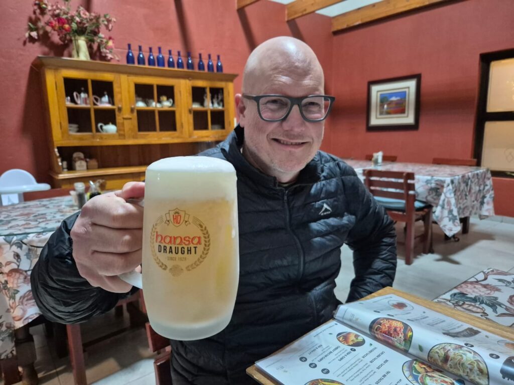
We had dinner at the lodge’s restaurant. Dinner wasn’t spectacular, but I will return for the Hansa draught. These guys know how to pour a beer. The glass is frosted in the freezer and you’ll look far for a colder one.
The coldest beer in the southern hemisphere
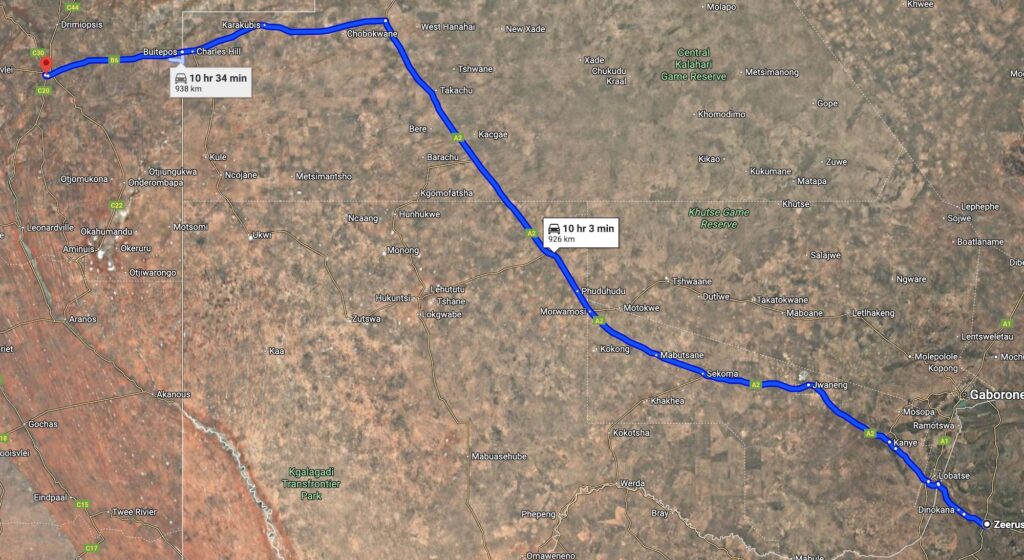
We were up early again the following day. Now it was straight through to Swakopmund, where we had to buy lots of provisions for the tour, so we had to get there as early as possible.
Gobabis to Swakopmund
The road was good, no potholes, and we got to Swakopmund by lunchtime and checked into our accommodation.
Despite having spent only half a day in Swakopmund, it deserves it’s own post – hope to see you there!
A point on travelling: we were two vehicles with two occupants each. If at all possible, I would suggest travelling in a group, because it is just easier and safer. We use walkie-talkies for communication between the cars, but the standard little ones without external aerials have limited range (typically mostly line-of-sight) and as such we often lost contact with each other. This was not major, and easy to manage for us, but if you want contact all the time you’ll have to invest in strong er walkie-talkies.
Summary of important points:
Remember your PASSPORTS!
Check border open and close times.
Know what you may and may not take through the border (no meats, dairy, eggs, etc.).
Know what mandatory items to take through border (reflective vests, fire extinguisher, two red triangles). We were not asked for these, but do you want to take the chance?
If you are coming back through Botswana, buy a re-entry visa, it saves quite a bit of money.
Adhere to speed limits.
Have an off-line GPS of some sorts.
Preferably travel in a group, with walky-talkies to communicate.
The Namibian Skeleton Coast is a destination that has an allure to most travellers and an affinity to bucket lists. Even non-travellers will likely be intrigued by the name alone; but seasoned travellers are likely to be aware of the harsh and challenging, yet beautiful nature of the environment.
On one side is the Atlantic Ocean – a stretch of water that is rocky, cunning and inhospitable. On the other, the Namib desert, where only the strongest survive; holding within it snakes, scorpions and other desert dwellers. Yes, even desert elephants and lions roam these parts.
The desert is home to wreckages of those seeking its’ riches, but also of those that managed to escape the perils of the Atlantic; only to be faced with an equal foe.
These days, modern vehicles makes it easier to explore this beauty of Africa, and so the question beckoned, why not?
To start off with, we turned to google to find out what our options were. One can explore the skeleton coast on your own, but only up to a certain point. The Skeleton Coast National Park can be entered by anyone, but on your own you can only explore up to Terrace Bay. After Terrace Bay, you are entering concession areas and only guided tours are allowed.
We found a tour that lasts for eight days, throughout the Skeleton coast to the Kunene river, then back south through Kaokoland and Damaraland. The tour is a self-drive tour – you bring and drive your own 4×4 vehicle, and you are responsible for your own camping equipment.
The tour includes breakfast and dinner, prepared for you by the guides as well as all the necessary concession arrangements. It also provides two-way radios to keep in contact with the rest of the group and through which the guides tell you about the various sites you’ll encounter. It came to approximately R15k per person (2025) – which is very reasonable, considering that you gain access to one of the remote gems planet earth has to offer.
There are no refuelling options, and driving conditions will result in very heavy fuel consumption – so you need to make sure that you carry in the region of 240-300 liters of fuel, depending on your vehicle. That is a lot of fuel, and I can’t stress enough that you will spend a large amount of time in your vehicle; I hope you like the allure of the open road.
I suppose you could rent a 4×4, with the necessary equipment – but you are going to struggle if you have never previously driven a 4×4 vehicle over rough terrain. You need to understand the basics of tyre pressures (when and why to deflate), high and low range (low range is necessary for this trip) and diff locks (optional, in my opinion). The guides are really helpful, but this is not a training course – they are not set up to teach you from scratch.
Having meals prepared might sound like glamping (and it is – the meals are fabulous), but bear in mind that one way or another you will still sleep in a tent, and spend large parts of your day in a car. Again, if this sounds completely foreign then know that it will be a bit tough on you; it is not a hotel and you cannot check-out halfway through if you decide that roughing it isn’t for you.
But, if you are (fairly) used to camping, and you have a 4×4 vehicle in good, working condition, and you understand the basics of 4×4 driving, then this is an adventure that you will likely remember for the rest of your life. Note that the 4×4 must be something with low range; and you should definitely not have low-profile tyres. You are going to deflate to 1 bar and possibly even lower, so a low profile tyre will be driving on the rim and get damaged and you’ll be stuck. Actually – you won’t, because it is unlikely that you will be allowed to continue.
If you don’t drive your car on dirt roads because you’re afraid of paint chips or other damage, then you need to know that your 4×4 is going to do what it was made for on this trip. It will work hard, through rough terrain and you may lose a tyre or two. An all-terrain tyre that has strong off-road capabilities is recommended and in my opinion, tyres should be in a good condition (50% or more life left). I used a set of General Grabber AT3’s, and they were prefect for the job.
The itinerary (in a nutshell) starts at Swakopmund. From there we travel northward to the entrance of the Skeleton Coast national park. Then you will follow the coastline (broadly speaking) northward to the Kunene river mouth and views of Angola on the other side. After that, you turn east and cross the dune belt that runs along the coastline. You are now in Kaokoland and from there you will travel roughly South until Sesfontein in the Damaraland region.
The rest of this post is divided into the various parts of the trip and what you will experience on each section. If you are going to do the tour and you would like for it to be a surprise, then you should probably not read through the details. But personally, I think no matter how much you know, reading about it is much different to experiencing it – you have to get out there.
We booked through a tour operator, but the company is Skeleton Coast Tours and the link will take you directly to their website – speak to Hein.
Our guide has his own tour that goes west to east through the southern parts of Namibia – if you’re interested in such a tour contact Luciano of Endless Sands Expeditions (but note again that is a different tour, NOT the one dealt with in this series).
Contains information related to marketing campaigns of the user. These are shared with Google AdWords / Google Ads when the Google Ads and Google Analytics accounts are linked together.
90 days
__utma
ID used to identify users and sessions
2 years after last activity
__utmt
Used to monitor number of Google Analytics server requests
10 minutes
__utmb
Used to distinguish new sessions and visits. This cookie is set when the GA.js javascript library is loaded and there is no existing __utmb cookie. The cookie is updated every time data is sent to the Google Analytics server.
30 minutes after last activity
__utmc
Used only with old Urchin versions of Google Analytics and not with GA.js. Was used to distinguish between new sessions and visits at the end of a session.
End of session (browser)
__utmz
Contains information about the traffic source or campaign that directed user to the website. The cookie is set when the GA.js javascript is loaded and updated when data is sent to the Google Anaytics server
6 months after last activity
__utmv
Contains custom information set by the web developer via the _setCustomVar method in Google Analytics. This cookie is updated every time new data is sent to the Google Analytics server.
2 years after last activity
__utmx
Used to determine whether a user is included in an A / B or Multivariate test.
18 months
_ga
ID used to identify users
2 years
_gali
Used by Google Analytics to determine which links on a page are being clicked
30 seconds
_ga_
ID used to identify users
2 years
_gid
ID used to identify users for 24 hours after last activity
24 hours
_gat
Used to monitor number of Google Analytics server requests when using Google Tag Manager